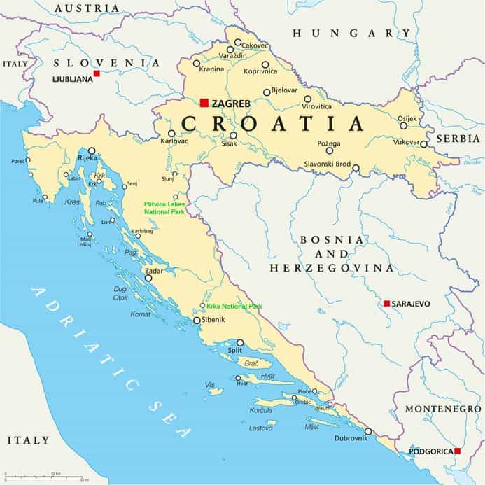
Here’s a static Croatia map for an overview the country:
Below is a Croatia map showing the twenty counties in the country:
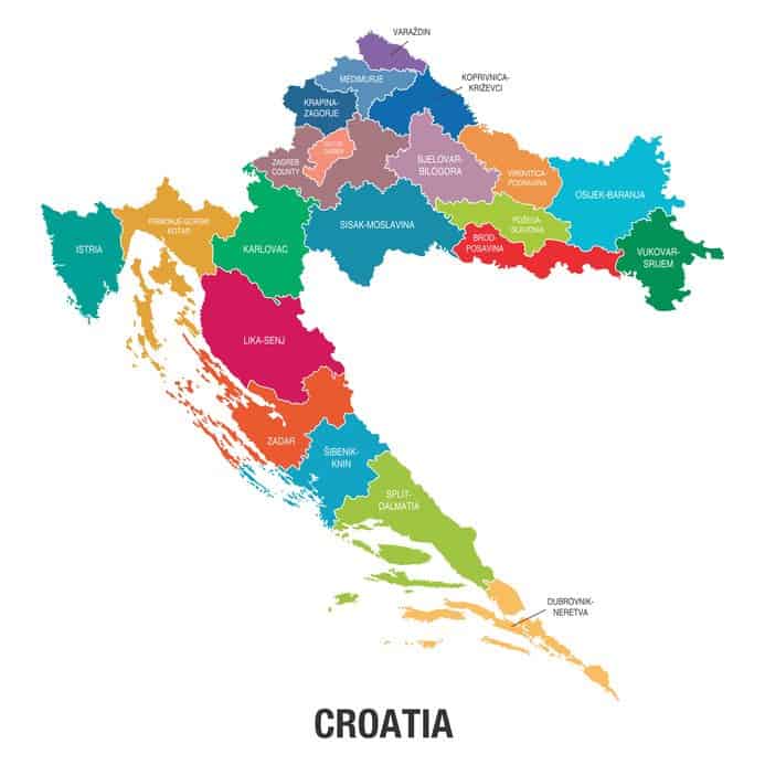
They twenty counties (plus the city of Zagreb) in Croatia are:
- Istria (with Pula, Porec, Rovinj)
- Primorje Gorski-Kotar (Rijeka, Opatija, Krk, Cres, Losinj, Rab)
- Lika-Senj (Plitvice Lakes National Park)
- Zadar (Zadar, Pag, Paklenica National Park)
- Sibenik-Knin (Sibenik, Krka National Park, Kornati National Park)
- Split-Dalmatia (Split, Brac, Hvar, Vis, Trogir, Makarska)
- Dubrovnik-Neretva (Dubrovnik, Korcula, Mljet, Elafiti Islands, Orebic)
- Karlovac (Karlovac, Ogulin)
- Zagreb County (Samobor; note: the City of Zagreb is a separate entity)
- Sisak-Moslavina (Sisak)
- Krapina-Zagorje (Krapina)
- Medjimurje (Cakovec)
- Varazdin (Varazdin)
- Koprivnica-Krizevci (Koprivnica, Krizevci)
- Bjelovar-Bilogora (Bjelovar)
- Virovitica-Podravina (Virovitica)
- Pozega-Slavonia (Pozega)
- Brod-Posavina (Slavonski Brod)
- Osijek-Baranja (Osijek, Djakovo)
- Vukovar-Srijem (Vukovar)
Please also see Karte.hr – they have interactive maps of Croatian cities.
Other Croatia Maps
Do also check out our interactive map of Croatia, which shows some of the main points of interest in the country. Alternatively, you may like to take a look at our Map of the Croatian Islands to familiarise yourself with where some of these are located.
Additionally, take a look at the following maps which are searchable/scrollable:
And if you really like your maps, we’ve also got a map of the main ferry and catamaran routes that operate off the coast of Croatia!