Where’s the Point of Inaccessibility in Croatia?
Where is the point of inaccessibility in Croatia? And more to the point – what is a point of inaccessibility?
We were contacted by traveller Chris Brown who recently visited the point of inaccessibility in Croatia – the coordinates of which are:
- Latitude: 45° 46.9747‘N
- Longitude: 16° 29.8791’E
which is about 55km west of Zagreb and 8km south, south east of Dubrava, meaning it is in a small rural village called Mostari. At the Croatian point of inaccessibility, the nearest border is 61.4km away.
So, what is a Pole or Point of Inaccessibility?
Traditionally, the Pole of Inaccessibility for a large landmass like a continent, or an island, is the point furthest away from the ocean in any direction.
The easiest way to imagine it is to take a map of the land mass and draw the biggest circle you can without touching the ocean. The centre of that circle is the Pole of Inaccessibility.
Chris has simply extended that concept to any country or state where the border is well defined and called those POINTS of inaccessibility.
Chris has made it a hobby/mission to visit as many Poles of Inaccessibility (continents) and Points of Inaccessibility as possible. And during a trip to visit the famous Rimac factory in Zagreb, he was presented with the opportunity to visit the Croatian POI.
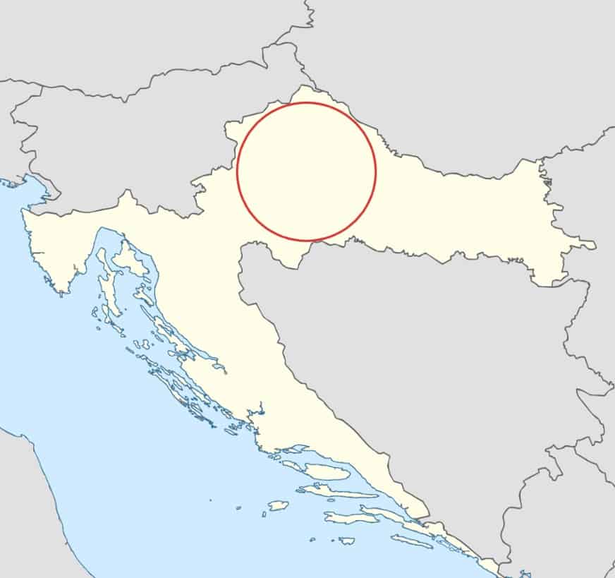
You can see from this sketch below that any other point in Croatia is closer to the border than the centre of the red circle – that centre being in Mostari.
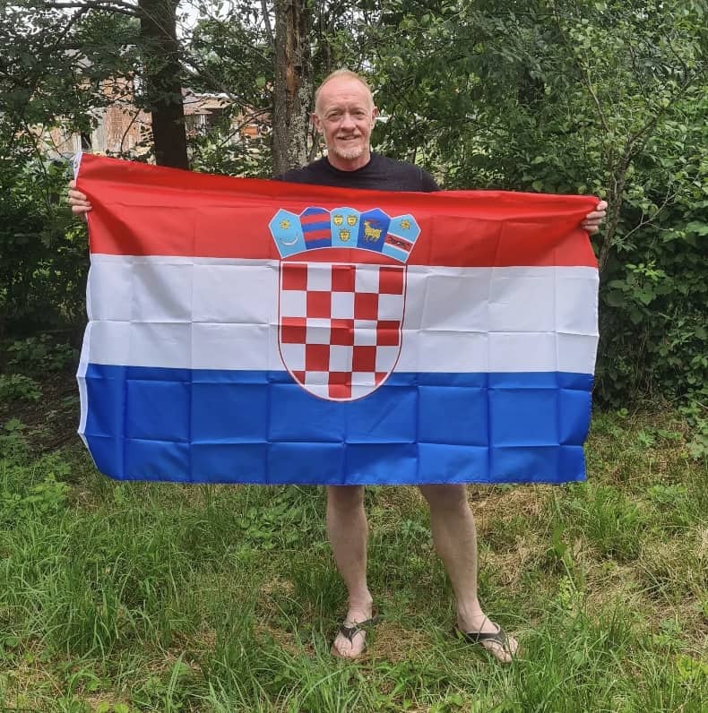
This is Chris standing at the POI for Croatia (well, actually 9m from the exact point because it was on private land).
You can learn more about points and poles of inaccessibility on Chris’ blog at inaccessibility.net and, in particular, his travels to the Croatian Point of Inaccessibility.


